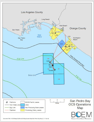
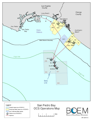
Maps of Huntington Beach oil spill with an estimated 126,000 gallons of crude oil flooding into the ocean.
In partnership with federal, regional, & local response entities, clean-up efforts are underway on an approx. 6 mile oil spill along our coast. Responsible party, Amplify Energy Corp, to assist with clean-up.
— City of Huntington Beach (@CityofHBPIO) October 4, 2021
For info about closures & volunteer ops: https://t.co/VN1y6N3Hlt pic.twitter.com/1CfYrRvknX
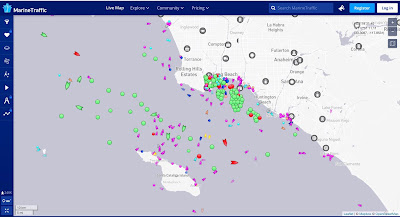
There have been allegations that the oil spill off Huntington and Newport beaches was caused by one of the many ships anchored off @PortofLA @portoflongbeach. As can be seen, the ships are anchored on the shallow shelf and no where need the source of the oil spill in deep water. pic.twitter.com/mJxdVzdh1j
— Sal Mercogliano 🚢⚓🧭🐪🚒🏴☠️ (@mercoglianos) October 4, 2021
#AmplifyEnergy offshore Southern California (Beta) operatons map pasted below. $AMPY shares -34% in pre-market following California offshore oil spill. Oil spills/leaks are never good for anyone especially if happens offfshore as harder to control. #OOTT pic.twitter.com/9Ri2Wgxv7O
— Dan Tsubouchi (@Energy_Tidbits) October 4, 2021
New map of Huntington Beach oil spill including pipeline and platforms. Closest vessel to pipeline, near the visible slick, is Rotterdam Express. Did they drop anchor on this pipeline on the evening of Oct 1? https://t.co/GiQ7FYn2dW pic.twitter.com/Lk7b7Erdte
— SkyTruth (@SkyTruth) October 4, 2021


